
Shegar
Shegar (also called New Tingri) belongs to Tingri County under the Shigatse City, which is about 600km away from the capital city Lhasa. The altitude is about 4,200 meters above sea level, which is the closest town towards Mount Everest region. It is also the political, economic, and cultural center of Tingri County. The public service facilities such as roads, water supply and power supply in the town are basically complete.
Shegar is a large passageway leading to South Asia and the rear base of the two major China-Nepal borders: Zhangmu and Gyirong. It is also the only road to Everest National Road 318, and the planned National Road 219 South Line will meet here as well. It is an important transportation hub leading to all townships in the whole county.
Shegar is where you can buy your entry ticket to visit the Qomolangma (Everest in Tibetan language) Nature Preserve. Inside the preserve are Mount Everest Base Camp, Rongphu Monastery and Mount Cho Oyu Base Camp. The preserve office is in the QNP San Cheng Guesthouse.
Shegar itself lies a 7 kilometers diversion northwest of the China-Nepal Friendship Highway. Tourists always have a stop here to have breakfast after Lhatse or stay here overnight before heading out early the next morning to Everest Base Camp. There are a few Chinese, Tibetan, and Muslim Restaurants here, together with some budget standard hotels/guesthouses, but most of them charge overpriced. From Shegar there is no public transport to Rongbuk monastery and Everest Base Camp, the only possibility is to hitch the private vehicle.
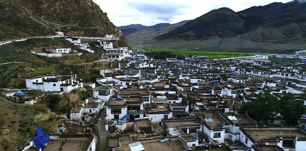
Shegar is built on a mountain, and a river runs through the middle of the city. Looking up, you can see the buildings of the ancient fort (Dzong) on the mountain. In many parts of Tibet, Dzong (Dzong architecture is a distinctive type of fortress architecture found mainly in Bhutan and Tibet) architecture remains. For example, the ruins of the Guge Kingdom and the Gyantse Dzong are world-famous architecture. The remains of the Dzong’s defensive walls snake up the near-vertical pinnacle that looms over the town.
If you have time, it’s worth making a short Kora around the town. A 2 kilometers Kora trail leads up from the western side of town to the top of the steep crag. Along the way, you can see Mount Everest in the distance if the weather permits. Morning light is the best for taking photographs.
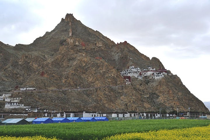
On the way up you will pass the Shegar Chode Monastery (Altitude 4,050m), a small Gelugpa institution built-in 1269. The monastery is located on a towering hill, very few tourists go deep into this corner. From the mural on the left side of the entrance of the main hall, you can see that the monastery once occupied the grandeur of the entire mountain in the 14th century. However, after being destroyed, the ubiquitous ruins are more worth visiting than the monastery itself. These ruins extend to the top of the mountain.
More than 90% of local people in the county are good at singing and dancing. Silverware processing, hand sewing, and other crafts have been circulating for thousands of years. In addition, there are still many more traditional folk customs, such as Wedding Customs, Equestrian Competitions, Luoxie Dance Festival, etc. Most villages are built on the mountain, with a compact layout and distinct levels, forming beautiful folk customs.
As its special geographical location and unique natural environment, Shegar has formed a cultural and artistic hometown of important cultural relics, traditional singing and dancing with distinctive characteristics, exquisite ethnic handicrafts, and simple folk customs.
Related tours


